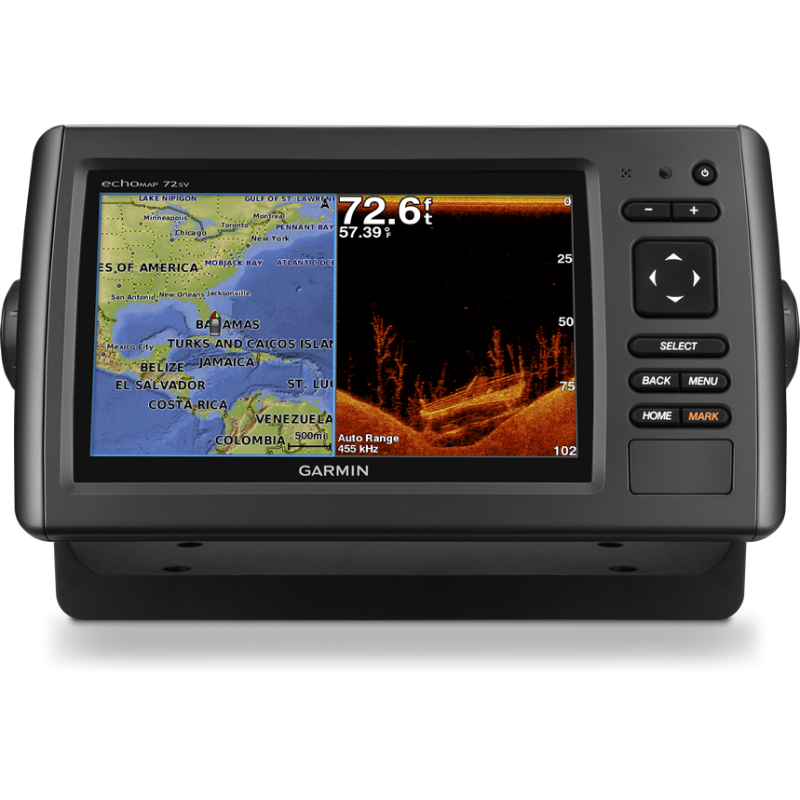


EchoMAP 72sv includes a screen to color of great contrast of 7 inches with automatic adjustment of the retroiluminación. The system GPS/GLONASS of 5 Hz, rapid and with great capacity of response, updating the position and the course 5 times per second in order that the movement on the screen is more continued.

Safe shopping. Encrypted navigation with SSL for your security.

Free shipping on purchases over €150

Money-back guarantee if you are not satisfied
With the receptor GPS/GLONASS of 5 Hz integrated of Garmin, echoMap 72sv updates your position and the course up to 5 times per second.Fluid and constant location on screen and demonstrates an incredible precision on having marked intermediate points and on having sailed.
The wireless integrated connectivity you allows you to connect and to accede to nautical applications across a smartphone or a tablet.
The cables of the combined device connect directly to the support, which allows you to install and to withdraw rapidly the device of the support, as well as to disconnect it of the supply. Support for assemble in mirror of stern and motive for fishing of curricán included.
Garmin DownVü scanning sonar gives you a nearly photographic image of what passes below your boat. Garmin SideVü scanning sonar gives you a clear view of what lies up 225mts off to each side of your boat. You clearly see structure, submerged objects and fish. Traditional Garmin HD-ID sonar and both DownVü and SideVü scanning sonar are combined into one transducer. Also provides HD-ID support for Minn Kota and MotorGuide trolling motors with integrated transducers.
The echoMAP 72sv also includes sonar-recording capability that coordinates the timing of the sonar return with your boat's position and saves digital information for playback on a computer using free HomePort™ planning software. Use the User Data Sharing Cable to share waypoints and routes between multiple devices.
 More extras with Garmin´s cartography
With the card SD BlueChart g2 Vision, you can add the only functionalities to your plotter:
Say good-bye to the troublesome process of plugging cables and to unplug them of the unit, because these connect directly to the support. This will allow you to install and to withdraw rapidly your echoMAP of the support, as well as to disconnect it of the supply
Enter the location you want to go, look through the cards instantly to create a safe route in the virtual screen, helps you avoid shallow water, low bridges and other obstacles along the way.
With improved version 2.0, you can now access more features and options. Calculated automatic routing point can customize to enter the point of "provisional" for bridges or points of interest in the desired manner. Dangerous point in the calculated route can easily navigate. It can connect your compatible Garmin autopilot to follow the route of the automatic steering. Other improvements in version 2.0 allow you to calculate the arrival time at any point on its route (corresponding perfect time arrivals opening bridges and other events of limited time). Now you can save the planned route with automatic guidance for future navigation for a backup of the SD card with maps and trade VISION® BlueChart g2 or Lake Vu ™ HD Ultra².